


The development and conservation of the deep-sea environment is a topic of global concern. How to carry out deep-sea mineral resource exploitation efficiently and in an environmentally friendly manner represents an urgent challenge to be addressed. Cui Xiaodong, Professor and Master’s Supervisor at the Department of Hydrography and Marine Surveying, College of Geodesy and Spatial Information, Shandong University of Science and Technology, leads a team to launch the project “Jingwei Deep-Sea Exploration – A Pioneer of Smart Marine Acoustic Detection Solutions”. Focusing on three major technical bottlenecks: refined processing of seabed topography, intelligent classification of seabed sediment, and intelligent identification of deep-sea minerals, the team has developed the “Jingwei Deep-Sea Exploration” smart marine acoustic detection solution.

Over the past two years, the project “Jingwei Deep-Sea Exploration – A Pioneer of Smart Marine Acoustic Detection Solutions” has been successfully applied in sea areas including the Pacific Ocean and the Arctic Ocean, completing detection tasks covering seabed topography and geomorphology, seabed sediment, and polymetallic nodules.
Cui Xiaodong notes that marine surveying and detection technologies can deliver precise fundamental data for marine resource development and utilization, marine engineering construction, marine environmental protection and maritime security assurance, serving as a critical component in the advancement of marine undertakings.
Previously, industry bottlenecks persisted in marine detection, including insufficient accuracy of full-water-depth topographic survey, poor interpretation of seabed sediment, and difficulties in the precise prediction of deep-sea mineral resources. To resolve these challenges, the team, relying on the Key Laboratory of Marine Surveying of the Ministry of Natural Resources hosted by the university, has long devoted itself to the research and development of acoustic detection technologies dominated by multi-beam systems. The team explores the use of acoustic data to realize large-scale, high-resolution, high-precision modelling of seabed topography, geomorphology and seabed environments.
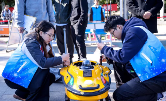
The team conducted field research among upstream and downstream marine exploration enterprises and research institutes across multiple provinces. It developed the technical system tailored to industry needs. After hundreds of rounds of data testing and technical iteration, the team ultimately built a smart marine acoustic detection and interpretation system with fully independent intellectual property rights.



wydf@wydf.org.cn

